The Digital Trail:
How Technology Helps Strengthen
the A.T. Experience
By Elizabeth Choi
“Technology is anything that was invented after you were born.”
~Alan Kay, computer scientist and personal computing pioneer
Technology used on and for the Appalachian Trail has progressed a great deal since Myron Avery used his measuring wheel on the way to Katahdin, improving the A.T. for everyone. But what hasn’t changed — nearly one hundred years later and regardless of which tech-based tools are used —is the incredible feeling of hiking the Trail. Top photo by Chris Bennett. Bottom photo by Mark Taylor
An early twentieth-century measuring or surveyor’s wheel basically looks like a bicycle rim attached to a pole. The distance between two points can be measured by rolling the device along the ground. Once the wheel completes a full rotation, it emits a clicking sound. The total distance is then calculated by multiplying the number of clicks with the circumference of the wheel.

In 1930, Myron Avery embarked on a solo hike across the Appalachian Trail while pushing a measuring wheel over the terrain. Avery, founder of the Potomac Appalachian Trail Club and chairman of the Appalachian Trail Conference for twenty-one years, was responsible for the mapping of the first official route of the A.T.

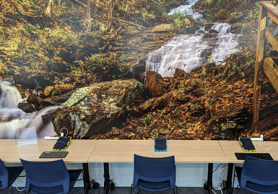
Technology has always been part of Trail history, and newer technologies such as GIS are continuing to shape how we understand and experience the A.T. GIS, which stands for geographic information system, is a computer system that collects and stores information from a variety of data sources. This information can then be displayed through maps, charts, and other visual formats, allowing users to discover relationships, patterns, and trends concerning a location. When people are looking for nearby restaurants or local traffic conditions through apps on their phones, they’re using programs made possible by GIS.

In 1998, the Appalachian Trail Conservancy used GIS to create the first “on-screen” digitization of the A.T. Much of the on-trail work was done by ATC volunteer, Dr. Vernon Vernier, who many other hikers knew as “Del Doc.” He would begin a more detailed survey several years later using high-end GPS equipment — a Trimble ProXRS with a handheld TSC1 data collector running Asset Surveyor field software, to be precise. After Vernier passed away, the work was completed by ATC members Karl Hartzell and John Fletcher.

Today, the ATC is using GIS to collect visitor and Trail data in order to make management decisions, as well as to create maps. Since the A.T. is an important north-south migration corridor for wildlife, the ATC is also using GIS to assess and monitor the corridor boundaries and the rare species that inhabit and traverse the Trail.

What does “crowded” really mean?
Knowing how many people are actually on the Trail from day to day is crucial for knowing how to properly allocate resources and for anticipating and planning for possible issues. But how you define “crowded” can vary depending on who you ask. As Monica Mogilewsky, Visitor Use Management Data Manager for the ATC, explains, “For some people, that might be four people. For others, that might be 40 people. It’s not until you start presenting numbers that you realize that there’s a difference in what people are talking about when they say, ‘The Trail was crowded.’”
tablets on table with blue chairs in the foreground and a forest wallpaper on the wall
Above: At Basecamp, tablets are provided for online registration. In addition to helping hikers with the registration process, members of the Georgia Appalachian Trail Club (GATC) offer vital assistance to those starting their Trail journey — including providing hangtags, carrying out helpful pack shakedowns, and conducting informative daily presentations. The knowledge and experience these volunteers generously share are essential to preparing a thru-hiker for the trek north. Photo by Monica Mogilewsky.

Below: Hikers aren’t the only ones who benefit from improved Trail technology like GIS. In Pennsylvania, the A.T. crosses through 227 miles of the Kittatinny Ridge. In addition to providing clean drinking water for thousands of people, the landscape also shelters many endangered, threatened, and migratory species, including the bog turtle (Glyptemys muhlenbergii). A local conservation organization asked its partners to help incorporate their priorities into a five-year strategic plan. In response, the ATC built a GIS tool that aggregates data — from thirteen counties and around 930,000 individual properties — in order to share its conservation values. Since then, more than sixty organizations in Pennsylvania have engaged with the tool and provided important feedback. Photo by U.S. Fish and Wildlife Service

close up of bog turtle on grass
One place to get quantitative numbers is at A.T. Basecamp. North-bound hikers who wish to complete the entire 2,190-plus miles of the A.T. are required to register with the Georgia Department of Natural Resources at Amicalola Falls State Park. In the past, Basecamp registration was done on paper. This year was the first time that thru-hikers were able to complete the process digitally using an app developed by Robert Peterman. At Basecamp, hikers uploading their information are assisted by dedicated volunteers and Trail Ambassadors from the Georgia Appalachian Trail Club. “Digitization has made a world of difference,” says Mogilewsky. “Data collected on paper is only useful for the folks who have those papers, and we often need to make decisions on the Trail in a more timely way.”

The Department of Natural Resources system in Georgia is also now linked to the ATC’s ATCamp, speeding up the state’s registration process for those who have initially entered details into the ATC’s platform. The ATC set up the ATCamp voluntary registration system to allow thru-hikers to see how many other hikers have registered that season according to start dates and locations. At Amicalola, a thru-hiker can enter their ATCamp number in the state’s portal, which will then autofill much of the form. The thru-hiker information from ATCamp, as well as from Basecamp, helps ATC volunteers in managing the Trail and its shelters.

Mogilewsky also views ATCamp as a “Choose Your Own Adventure” tool for thru-hikers. “For a lot of people, being part of the community is an important part of their thru-hike experience. We offer ATCamp registration so that you can see what other people are doing in that given year. At the same time, some people hike the Trail to disconnect.”

Gathering insights on day trekkers
By contrast, getting quantitative data on day hikers can be a bit trickier. Ridgerunners employed by the ATC are tasked with reporting on visitor counts, new unsanctioned social trails, damage to shelters and other facilities, and other vital information. Their written reports are normally handed over to local trail managers after a five- or seven-day patrol. In the meantime, visitor use managers and other ATC staff must wait weeks or longer before they can view this data.
A campsite inventory technician using the RIMS app on his phone
close up of RIMS app on smart phone
Above: A campsite inventory technician uses the RIMS app on his phone while gathering data about campsites on the Trail. Photos by Jeffrey Marion.

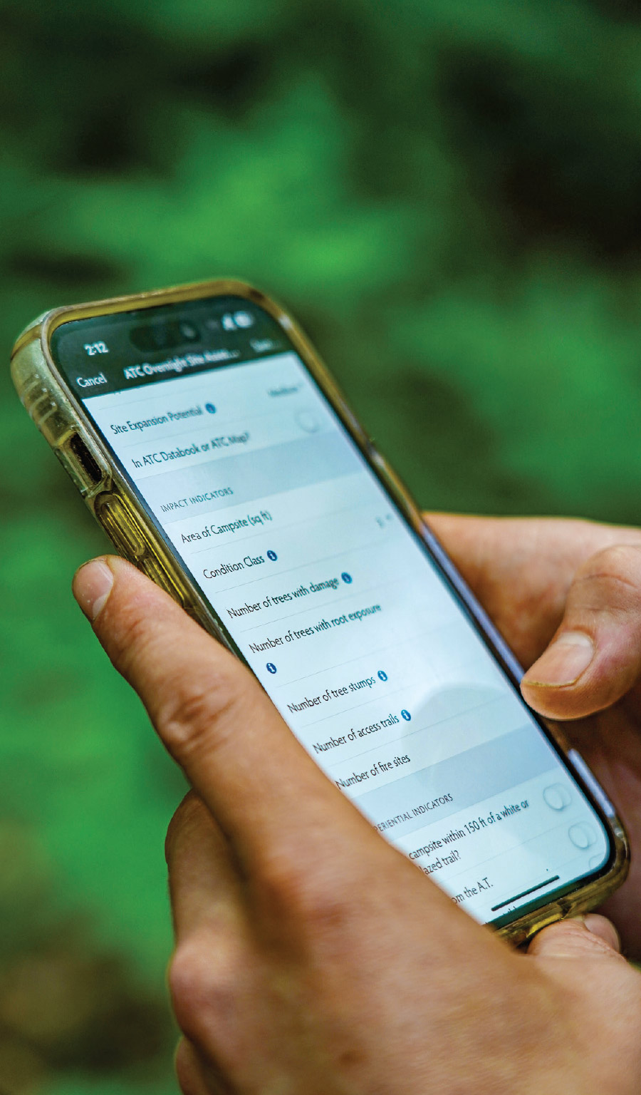
Below: Collected data can be used by ATC staff, partners, and volunteers to improve maintenance strategies along the A.T. and the Trail corridor. Volunteers shown here are helping with native plantings at Max Patch. Photo by Anne Sentz

Volunteers helping with native plantings at Max Patch
“Digitization has made a world of difference…Data collected on paper is only useful for the folks who have those papers, and we often need to make decisions on the Trail in a more timely way.”
~Monica Mogilewsky
To help close these time and data gaps, the ATC has recently started using the Recreation Impact Monitoring System, or RIMS. It is a GIS data collection tool developed by the Colorado Mountain Club to help public land managers gather data on trails and recreation facilities. The Colorado organization has made RIMS available for use across the country. Staff, volunteers, and even visitors can enter information on their smartphones, which can then be transmitted and viewed in a central RIMS database within 24 hours. “I might use RIMS if I’m out on the Trail doing maintenance, or if someone has a really specific question,” says Caitlin Miller, Information Services Manager at the ATC. “We get reports sometimes from hikers about tree blowdowns. It would be helpful for trail managers to be able to see whether or not something has been reported and has been taken care of.”

RIMS could also potentially have broader applications for hikers in the future. “Eventually, what we hope to do is leverage this data into something that’s easier for people to see,” says Mogilewsky. “Instead of having to log in to RIMS, they could just pull up a GIS interactive map on the ATC website and see things like locations for good solitude hikes or for a social gathering. We’ve just begun implementing RIMS, but we hope that it can be used as a tool for day hikers.”

Data’s role in the rehabilitation of Max Patch
Max Patch is a prime example of how the ATC uses technology to obtain tangible data that leads to decisive action. At Max Patch — the virtually treeless summit located on the North Carolina part of the A.T. bordering Tennessee — the ground is covered in thick native plants, such as perennial grasses, pasture grasses, ferns, and wildflowers. It is the ideal habitat for at-risk wildlife, such as the golden-winged warbler. The Carolina Mountain Club (CMC) works to help maintain this section and the surrounding 94 miles of the A.T. In 2018, the CMC began collecting data related to changes to Max Patch that trail ambassadors found concerning. (For this project, CMC used a precursor to RIMS.)

Then came the pandemic. The number of visitors to Max Patch increased. Fences meant to keep people out of protected areas were knocked down. Vegetation was trampled, creating unsanctioned footpaths. CMC volunteers removed trash by the truckloads every week.

Because of the constant data collection efforts by the CMC, the ATC was able to measure the extent of the damage. ATC staff was able to incorporate the data into their regular efforts to maintain ideal conditions in the region. The data collection also led to the Appalachian Ranger District of Pisgah National Forest instituting a forest order banning fires and camping and restricting other activities so that the highly impacted areas can recover.

However, not all of Max Patch had been subject to the same bans and restrictions. As a result, there was confusion about which areas were actually open. Technology — specifically GIS technology — was used to create better maps so visitors could still enjoy the Trail.

Digital tools for hikers
“I thru-hiked the Trail in 2015, and people were using paper maps and paper guides,” says Dakota Jackson, ATC’s Senior Director of Visitor Engagement. “Nine years down the line, it’s clear that technology has basically transformed what it means to be hiking on the A.T.” Hiking apps have made the A.T. more accessible, with some apps providing a “one-stop shop” for trip planning. The ATC has recently partnered with FarOut, a navigational app for long-distance trails, to supply FarOut users with the ATC’s most current Trail data. A portion of the proceeds from each FarOut A.T. map and A.T.-derived maps purchase supports the ATC’s mission.

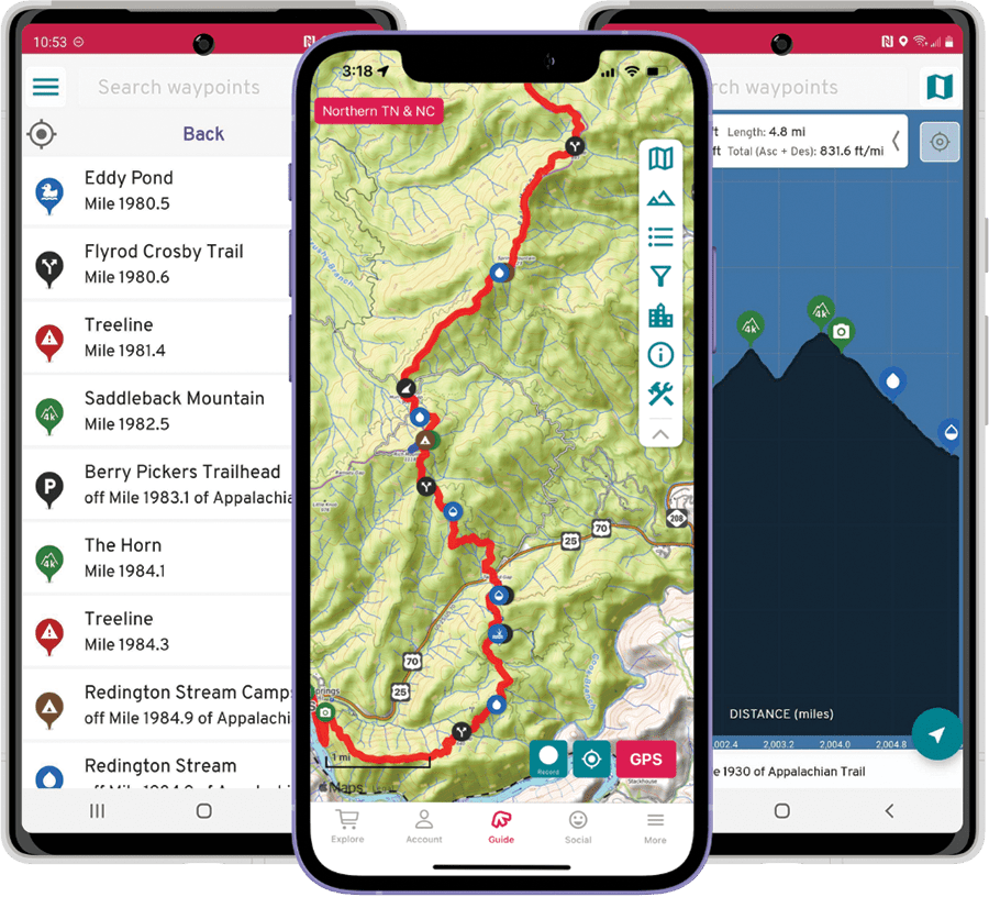
FarOut users have found the app’s crowd-sourced information to be especially useful. “I’ve heard from hikers that the comments on water sources have been invaluable for planning their trips,” says Miller. “As someone who likes to solo hike, it’s always kind of comforting to be able to look at my day ahead to see if there are any big issues coming up, like dry water sources or busy road crossings. This can really help inform how I plan my day to day.” Adds Jackson, “It gives you that additional security blanket of current and up-to-date information from other users who are anticipating and expecting the same things that you are. So it’s nice to know what’s going on ahead.”

red french doors at Appalachian Trail Visitor Center; Digital Kiosk sign; smart device with QR code scanned
At the digital kiosk in Monson, Maine, a hiker will find a sign with a QR code (left) posted on the door. They can then scan the code to access Trail information on their device (right). Stewart Holt designed the digital kiosks and installed them at the trailheads at Amicalola Falls State Park, Springer Mountain, and Neel’s Gap. Herb Fithian of the Maine A.T. Club and the staff of Baxter State Park installed and help maintain the digital kiosk at Abol Bridge. Kiosk photo by Wendy Weiger. Sign and digital illustration courtesy of the Appalachian Trail Conservancy
Another technological resource available to hikers are digital kiosks. Equipped with local Wi-Fi, these allow hikers to access A.T. information on their phones in areas without cell service. The ATC has installed a number of these kiosks on the Trail with the help of partners and clubs.

Naturally, hikers should be aware of not relying too heavily on apps and devices. Reception tends to be spotty in remote, mountainous areas. Phones can get wet and batteries can die. “These apps are absolutely an added benefit for visitors,” says Jackson. “But at the same time, having a map and a compass, and knowing how to use them, is essential. An app should never replace any of the ten essentials that someone brings on the Trail.”

Future opportunities
The ATC strives to find a balance between conservation, stewardship, and recreational enjoyment. But rapid changes taking place both locally and globally are creating a host of challenges. Total visitor numbers have risen dramatically in the past several decades. Looking at thru-hiker data alone, there has been an almost 22 percent increase in registered* hikers compared to ten years ago. When viewing current registrations against numbers from twenty years ago, the difference is close to 71 percent. An increase in visitors has the potential to negatively impact plant and wildlife, trail conditions, and the enjoyment of other visitors. Analyzing visitor data will help the ATC and its partners manage these impacts.

While the protected landscape that surrounds the A.T. remains a critical carbon sink that helps to remove carbon dioxide from the atmosphere, climate change has made sections of the Trail hotter and drier. Hikers may have noticed that there are significantly fewer water sources compared to ten or fifteen years ago. Climate change has also led to an increase in extreme weather events, such as tornadoes, high winds, drought, and heavy rain that can erode the soil, injure hikers, knock down structures and trees, and impact viewsheds. Technological advancements will help assess risks and damage and better allocate resources where they are needed.

pack of 4 hikers walking through trail in forest
ATC’s digital resources on multiple smart devices
In addition to the ATC’s guidebooks, maps, and digital resources that provide detailed information to help visitors plan their hikes, the Conservancy’s partnership with FarOut gives hikers access to expert and up-to-date information to help them have safe and fulfilling Trail experiences. Photo by Jordan Bowman. Digital illustrations courtesy of FarOut
More data is helpful, but collecting and implementing it in a timely manner requires an increasing amount of resources and time. The scope and scale of A.T. data encompasses nearly 2,200 miles of treadway crossing fourteen states; six national parks and eight national forests; twenty-two Native Nations traditional territories; hundreds of local jurisdictions and surrounding communities; and multiple biomes with over 1,800 rare, threatened, and endangered species populations of plants and animals.

At the 2024 MIT Chief Data Officer and Information Quality Symposium, ATC President and CEO Sandra Marra emphasized the need for applying the correct, technology-based solutions, “There are opportunities through technology that could, in fact, aggregate these multiple sources of data, at least at a fundamental level for us, and then free up [the ATC’s] limited staff and resources to start doing more sophisticated analysis.”

The ATC’s partners, clubs, and other affiliations are essential to the Trail’s protection and the growing use of new technology to do so. However, funding is also a crucial part of that growth. The ATC is currently working to expand GIS capacities through an investment initiative for data, licensing, server capacity, and dedicated staff with GIS and technical expertise. Philanthropic contributions toward a range of ATC programs can increase the pace and scale of land protection and related decisions by providing local conservation partners with up-to-date, reliable, relevant, and usable conservation and recreation data.

During the MIT symposium, Marra explained, “The Appalachian Trail was built on the concept of being a place where people can get away from the problems of living. [It is] critical that we be able to protect and continue to provide that resource and that place for people.” As the ATC adapts to emerging technologies, the Trail can be preserved for the enjoyment of generations to come.

* 2017-2024 numbers based on ATCamp registration; pre-2017 numbers based on estimates from Basecamp registrations and Kennebec Ferry records
GIS For The Trail
According to Katie Allen, Director of Landscape Conservation, the ATC’s “landscape conservation and science and stewardship work employs GIS data to assess important lands that, when protected and stewarded, indirectly and directly sustain and enhance the visitor’s experience.”

ATLAS IT (A.T. Landscape’s Aggerated Spatial Information Tool) is one of several examples of the ATC employing GIS data and technology to support setting priorities and engaging partners in protecting specific lands. ATLAS IT is a decision-making support tool that helps conservation partners to understand how land parcels contribute to the protection of the Trail. Users can view and generate reports on these parcels according to various information layers, such as viewsheds, climate resiliency, ecological systems, cultural and historic sites, and more.

The NRCA (Appalachian Trail Natural Resource Condition Assessment) program is led by the ATC and the National Park Service to assess trends and vulnerabilities to the Trail’s natural resources and to inform management decisions. This ArcGIS Hub allows users to interact and visualize a wide range of NRCA data through story maps, apps, and web maps.

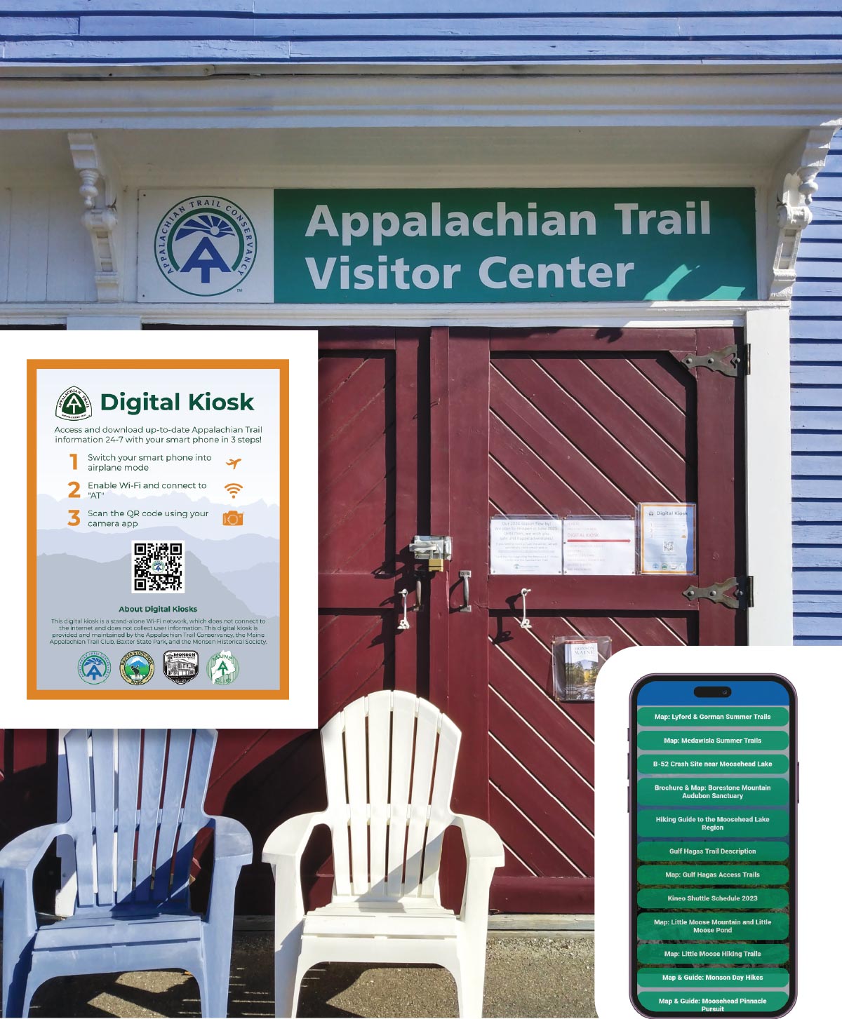
An interactive map of the A.T. was built cooperatively by the Appalachian Trail Conservancy and the National Park Service using ESRI’s Arc GIS Online mapping technology and can be found here: appalachiantrail.org/map