

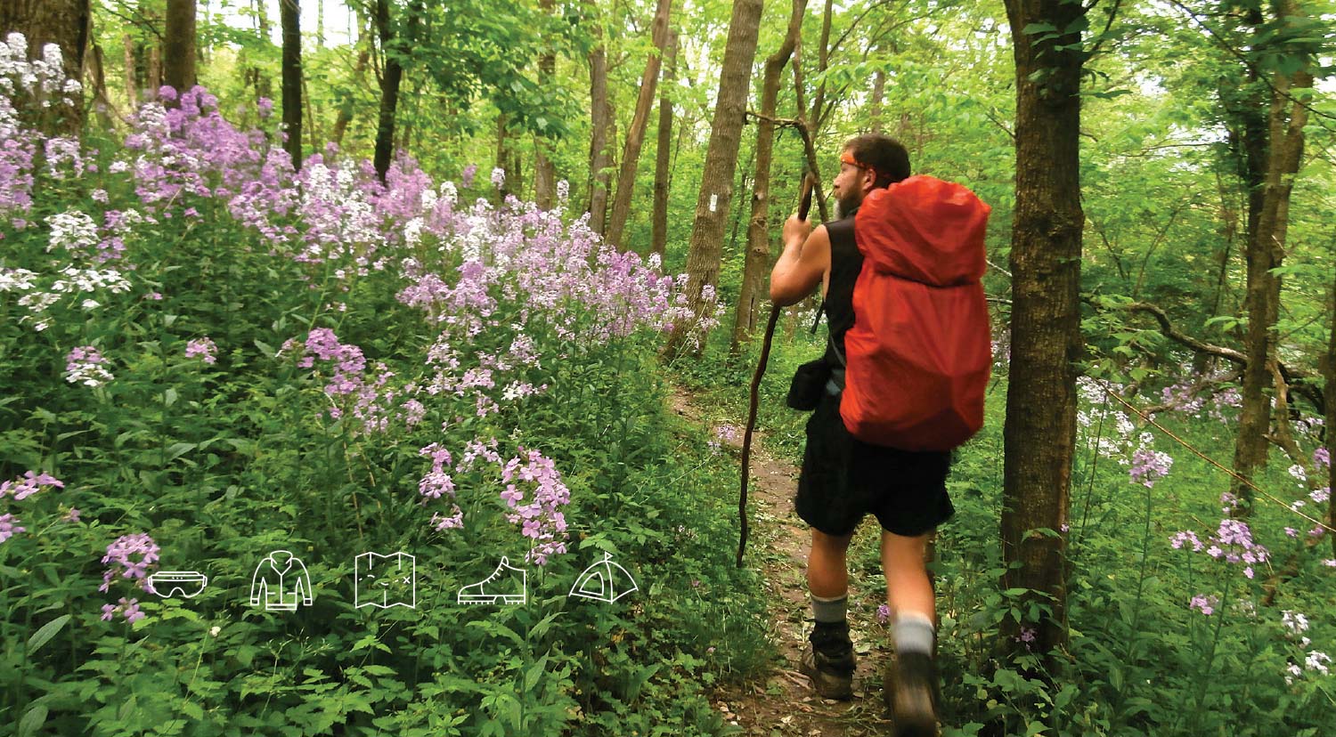
Spring wildflowers along the A.T. in West Virginia
![]() Photo by Raymond Salani III
Photo by Raymond Salani III
Having spent my entire childhood in
north Georgia and east Tennessee, at 17 I was presumptuous enough to think I knew the Appalachians. I had spent countless days exploring their rivers and trails. I loved their slopes and their swimming holes, their draws and ridges that undulated endlessly across the landscape. Then I moved to New Hampshire for college. The first time I saw the White Mountains soaring skyward from Franconia Notch on I-93, I felt like I was in a completely foreign land. There was no way that these sharp, imposing peaks could be part of the same range that hugged my hometown.
From those craggy granite peaks to the clear lakes of Maine and the picturesque pastures of Virginia, the Appalachians encompass many diverse landscapes, and the Appalachian Trail traverses them all. This variety is one of my favorite things about the A.T. Each section of Trail feels unique, and there are always new adventures to be had.
But because of this richness, planning a trip on the A.T. can be daunting — it’s like 2,190 destinations in one. How do you decide what section to hike? What state, even? And once you’ve settled on a destination, the questions have only begun. What do you need to bring? Do you need a permit? Will the Trail be overrun with summer campers singing their way down the mountain, or will you find the peace and quiet you desire? Well, worry no more. Consider this your guide to help you start planning your dream A.T. vacation.
April
Best for: Spotting wildflowers and flip-flop thru-hikers in the northern half of Virginia, West Virginia, and Maryland
Although the first half of April is unpredictable, the end of April is generally a pretty good bet for some warmer days and wild blooms along the A.T. in Virginia, West Virginia, and Maryland. If you’d like to meet some aspiring thru-hikers, you’ll encounter a smattering mostly walking north. A few dozen will start their journey around the time of the fourth annual Flip Flop Festival in the A.T. Community of Bolivar-Harpers Ferry, West Virginia, on April 28– 29. Check out the festival, then hike south to help disperse traffic. Winter conditions can persist anywhere along the Trail this month, so be sure to pack some extra non-cotton layers in your pack and stick to lower elevations. As with any hike in the Appalachians, don’t forget your rain jacket and pack cover or trash bag to waterproof your pack. If you decide to camp along the A.T. in Shenandoah National Park, you’ll need to acquire a free backcountry permit at a visitor center or entrance station. Some facilities may not be open for the season yet. In Maryland, you’re required to stay at designated sites overnight. Avoid hiking in New England (it’s still winter there) and in Georgia, North Carolina, Tennessee, and southern Virginia — high numbers of northbound thru-hikers and spring breakers searching for warmth make these states awfully crowded this month, which can make for an uncomfortable experience when you have to share a shelter site with dozens of other hikers.
May flowers on the Trail near Boiling Springs, Pennsylvania.
![]() Photo by Suzy McKelvey
Photo by Suzy McKelvey
May
Best for: Exploring the wild side of Pennsylvania, New Jersey, and New York
While the A.T. passes within an easy drive of several major cities in the mid-Atlantic, it feels surprisingly wild as it traverses beautiful river valleys, gentle ridges, bogs, and wetlands. The Trail meanders at relatively low elevations through these states, so it’s best to explore them before summer brings heat and humidity. Wear light-colored clothing that has been treated with permethrin (you can spray it on clothing you already own, buy pre-treated clothing, or send your clothing away to be factory treated), and check yourself at least daily for ticks, because these states are home to high concentrations of the disease carriers. Camping is only allowed at designated overnight sites in New Jersey, and New York, and restrictions vary widely in Pennsylvania, so you’ll need to plan your days wisely. Virginia becomes increasingly busy this month as northbound thru-hikers continue their journeys, and it’s still not quite time to hike in New England. The end of winter there simply ushers in the start of mud season, when trails range from unpleasant to impassible.
A July hike — crossing the Pleasant River in Maine.
![]() Photo by John Bilbrey
Photo by John Bilbrey
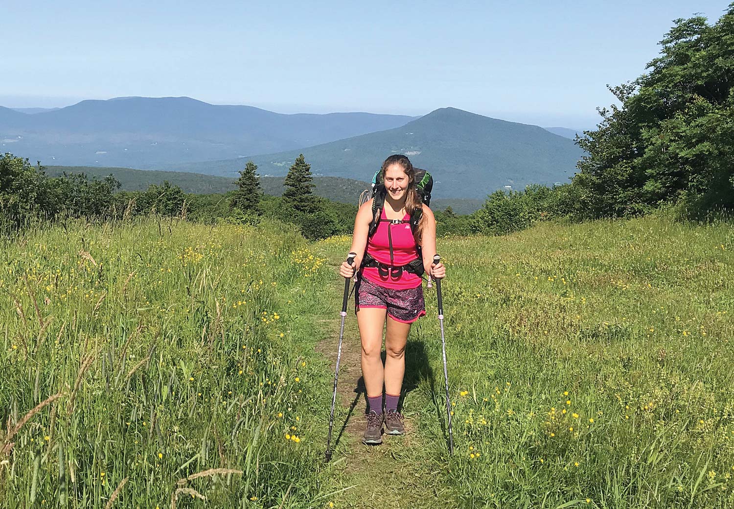
June
Best for: Taking in the vistas in Georgia, North Carolina, and Tennessee
Now that the wave of northbound thru-hikers has moved through, June is the perfect time to visit the Southern Appalachians. The high-elevation balds that dot this region provide beautiful views of the surrounding forests and towns, and picturesque waterfalls often await those willing to take short detours off the Trail. The A.T. Community of Roan Mountain, Tennessee, hosts their world-famous Rhododendron Festival just down the mountain from the A.T. on June 16 – 17, where you can experience this quintessential Appalachian flora in all its splendor. The month of June can get hot and humid at any elevation in the Southeast, so bring plenty of water and refill whenever you get the chance, being sure to treat and/or filter your water. The Appalachian Trail Conservancy (ATC) recommends using a bear canister to store your food along the entire length of the Trail, and proper food storage and bear awareness are especially important in the South. Bear-human interactions have become significantly more frequent in this region in recent years.
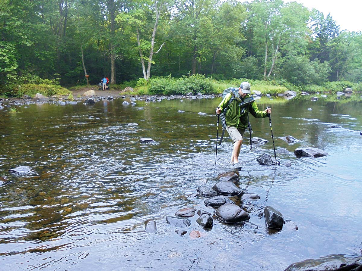
July
Best for: Beating the heat in northern New England
Those of us who are familiar with the Appalachians know that it gets hot in July. The higher elevations of Vermont, New Hampshire, and Maine stay a bit cooler this month, and their many lakes, creeks, and swimming holes provide welcome relief. Always exercise caution when swimming in natural bodies of water, and don’t swim alone. Maine’s many river crossings can be dangerous, especially after rain, so know your limits, remember to unbuckle your pack before crossing, and when in doubt — don’t cross. Never cross the Kennebec River on foot; the water can rise rapidly, and the ferry is the official route of the A.T. There are many summer camps and other groups who hit the Trail this month, so registering your hike using the ATC’s A.T. CAMP tool becomes especially important so you can avoid crowded campsites. And if you head to Maine’s Baxter State Park, be sure to do your research into the special rules and regulations there before your trip.
Late summer trek to Bromley Summit in Vermont.
![]() Photo by John Stifler
Photo by John Stifler
August
Best for: Embracing the last days of summer in southern New England
August is a wonderful time to experience summer in New England. The forest is lush, the days are long and, if you’re lucky, you may even experience the first crisp nights signaling that fall is soon to come. Just four miles from the Trail, the A.T. Community of Manchester, Vermont, knows how to celebrate summer in style. The Vermont Challenge bike race, the Green Mountain Bluegrass and Roots festival, sidewalk sales, and a fly fishing festival all hit town this month, so enjoy some classic New England charm and spend a night or two in town recuperating after your hike. Many college orientation groups will test their new classmates on the steep trails of northern New England this month, so stick to Connnecticut, Massachusetts, and southern Vermont unless you want to be kept awake by the sounds of get-to-know-you games played long into the night. Remember that camping is only allowed at designated overnight sites in Connecticut and Massachusetts, and these states also have restrictions on campfires. If you venture south of New England this month, bring more water than you think you’ll need; you’re likely to encounter dry water sources and persistent heat.
September
Best for: Finding some solitude in the Smokies
Great Smoky Mountains National Park is the most visited national park in the country, with almost 11.4 million visitors in 2017. A.T. hikers who visit the park in September, however, have a good chance of sharing stretches of Trail with few other people. Kids are back in school, leaf peepers won’t show up in droves until October, and most southbound thru-hikers haven’t made it quite this far yet. One group you may run into is the ATC’s Rocky Top Trail crew, so be sure to thank this merry band of volunteers for all their hard work. In the Smokies, camping on the A.T. is only allowed at designated shelters and campsites. Visit the park website to get a general backcountry permit in order to camp on the A.T. and other trails in the park. The A.T. stays mainly on high elevation ridges here, so you may see some early fall color, and you’ll need lots of layers and a three-season sleeping bag. In large part because of the high numbers of visitors and bears, the animals are particularly problematic in the Smokies. Before your go, read up on what to do if you see a black bear, and remember to properly store your food and all scented items, even small ones like lip balm, toothpaste and sunscreen — bears have a much stronger sense of smell than humans do. Bear canisters remain the most animal-resistant way to store food. A.T. campers who are carrying bear canisters in the Smokies should hang them on the cables provided at each shelter, as required by park regulations.
Fall colors on the Trail near Buena Vista, Virginia.
![]() Photo by Cathy Shiflett
Photo by Cathy Shiflett
October
Best for: Leaf peeping in Central and Southwest Virginia
While many people flock to New England, Shenandoah National Park, and western North Carolina to see fall foliage, the mountains of central and southwest Virginia put on a spectacular show of their own. The Mountain Day festival in the A.T. Community of Buena Vista, Virginia, which takes place October 13, highlights traditional Appalachian culture and generally coincides with peak color in the region. Elevations above 4,000 feet, common along the A.T. in Tennessee and North Carolina, often get below freezing this month. So, while it may seem counterintuitive, it’s best to stay north of Marion, Virginia, unless you enjoy and are prepared for some serious cold-weather backpacking. If the summer was dry, October can bring dry springs and high fire danger along much of the Trail, so be prepared to carry extra water, stay up-to-date on local fire restrictions and, as always, completely douse any allowable campfires you choose to build before you leave.
Before heading out on a hike, check the ATC Trail Updates page at appalachiantrail.org/updates to learn of any Trail closures or Trail conditions you need to be aware of.
And there you have it! While it’s certainly possible to backpack in the winter, conditions along the length of the A.T. can be unpredictable and even dangerous in the winter months, which is why I’ve only made trip suggestions from April to October. And remember — the ATC has a plethora of great information about planning any length of hike in any season on their website. Happy trails!
Books to help you plan YOUR next A.T. experience are available at the Ultimate A.T. Store

Appalachian Trail Thru-Hike Planner
Leave No Trace in the Outdoors – by Jeffrey Marion
The Best of the A.T. (available in May)
The Appalachian Trail Food Planner
How to Hike the A.T.: The Nitty-Gritty Details of a
Long-Distance Trek – by Michelle Ray
The Appalachian Trail by Day Hikes:
Tips for the Timid – by Polly Schoning
Best A.T. Hikes (New England, Mid-Atlantic, and South

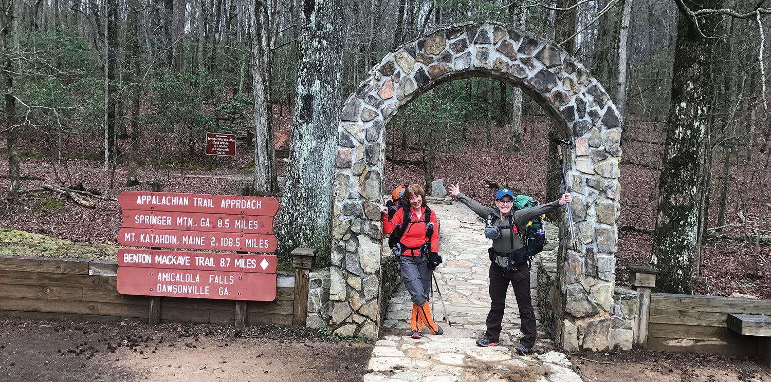
Start Well
at Amicalola Falls State Park
In 2016, in response to the increased pressure that growing numbers of thru-hikers placed on the natural resources of Baxter State Park, the ATC opened a Visitor Center in the A.T. Community of Monson, Maine. Almost 7,000 people visited the center in its first two seasons of operation, learning about topics including hiking the A.T. in Maine, Leave No Trace, and the local communities. In 2017, 83 percent of northbound thru-hikers (NOBOs) stopped in at the Visitor Center, where staff and volunteers ensured they knew about the free permit they would need within Baxter State Park. Seeing the success of this effort to help NOBOs Finish Well, the ATC – along with the Georgia A.T. Club, National Forest Service, and Amicalola Falls State Park (AFSP) — launched a new initiative this year to help them Start Well, too.
In the past, many NOBOs have chosen to start their journey by driving to near the southern terminus of the A.T. at Springer Mountain, as opposed to starting with the A.T. Approach Trail that connects Amicalola Falls State Park to Springer. Starting at Springer Mountain, however, can pose hazards to hikers and the Trail. The dirt Forest Service roads used to access Springer are sometimes impassable due to deep winter mud, and the small parking lot and nearby campsites are often overcrowded. For these reasons, the ATC has long encouraged NOBOs to begin at AFSP but with the increased numbers of thru-hikers, it is even more important — and an AFSP start also provides the best opportunity to provide NOBOs with crucial information.
So, beginning in February, ATC ridgerunners and volunteers from the Georgia A.T. Club began offering free courses designed to help thru-hikers understand the essential items and skills they need. “Every year, we see hundreds of aspiring thru-hikers set themselves up for discomfort, abandoned thru-hikes, and potential danger due to a lack of expert advice and preparation,” said the ATC’s southern regional director Morgan Sommerville. “The Start Well class is designed to help instill some of these valuable skills before NOBOs begin their journeys, simultaneously increasing their chances for success and, ideally, decreasing the impact they will have on the Trail itself.” Additionally, thru-hikers who start at AFSP are able to pick up the coveted A.T. hangtag they earned by registering their thru-hike through A.T.CAMP, the voluntary registration system, get a gear shakedown, and begin their journey by hiking through the iconic AFSP archway at the beginning of the Approach Trail. Early signs indicated that these efforts were successful in encouraging thru-hikers to consider their impact on the Trail: as of March 1, registrations of thru-hikers planning to start at Amicalola Falls instead of Springer increased from 52 percent to over 90 percent. When you Start Well, you are bound to Finish Well.
To register your thru-hike or overnight camping trip on the Trail visit: appalachiantrail.org/thruhikeregistration and atcamp.org