The Green Tunnel, Grazing Season, Spring Beauty Wildflowers, Rhododendron
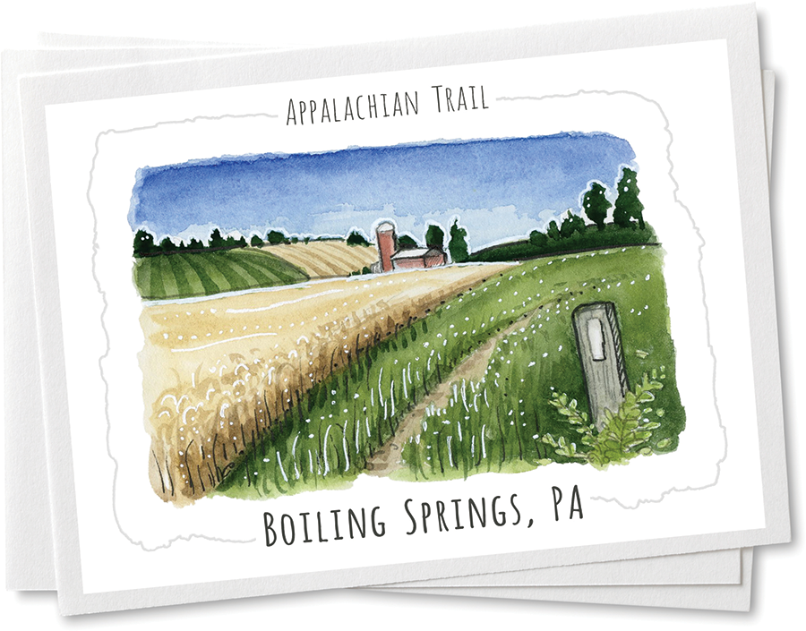
Boiling Springs, PA
Step Out Title
Easy travel and adventure await in an eclectic mix of Communities that run the length of the Trail
By Kim O’Connell / Illustrations By Rebecca Harnish
One recent Sunday morning, my husband and I were visiting my in-laws in south-central Pennsylvania when we decided to take a drive and do a short, day hike. I love the countryside there, with its apple orchards and farm markets peppering the rolling hills in all directions, and neighborly towns with cozy pubs and family restaurants. With my brother-in-law along for the ride, the three of us headed for Boiling Springs, a picturesque town in Pennsylvania’s Cumberland Valley.
We parked at the Appalachian Trail Conservancy’s mid-Atlantic regional office and Visitor Center, located in the heart of the town, and were immediately struck by how postcard-perfect Children’s Lake was. Reflecting the scudding clouds overhead, the lake was dotted with ducks and ringed by a historic red-roofed grist mill, charming houses, and the town’s war memorial. We stepped onto a portion of the Appalachian Trail where it borders the lake and walked towards the forest beyond the town. Our hike took us along a rocky stream, through some woods, and across an open farm field, which was studded with posts painted with white blazes so we wouldn’t lose our way. Later, on our way back to town, we stopped at the Boiling Springs Tavern, a stone structure dating to the mid-1800s, and the famous artesian spring behind it, with bubbling water that gives the town its name.

After we returned to our home in Arlington, Virginia, I couldn’t get Boiling Springs’ quiet charm out of my mind, and I felt sorry that our children had opted to stay back to visit with their grandfather. Even at their young ages of 9 and 12, my kids are veterans of many national park road trips, and they love hiking, camping, and traveling. Thinking about this, I pulled out a map of the A.T., tracing my finger along the route in search of other towns that we might visit together that would give us a range of things to do, along with easy access to the Trail. Almost 50 towns and counties have been named official Appalachian Trail Communities, meaning that they have signed on to be stewards and supporters of the Trail and its hikers. I knew that perusing that list would be a good place to start my trip planning.

The town of Fontana Dam was expressly built in the 1940s to house the Tennessee Valley Authority workers who built the massive engineering marvel, still the tallest dam on the Eastern Seaboard at nearly  500 feet.
Towards the southern terminus of the Trail, the town of Blairsville, Georgia, immediately caught my eye. There is something about the southern Appalachians that makes me want to connect with my Celtic roots. I think about how the Scotch-Irish settled many of these areas and brought their music and their craftsmanship into the mountains, along with other ethnic groups, and it’s a rich heritage worthy of celebration. Researching the town, I was drawn to all the ways it honors this rich natural and cultural heritage, including an annual Scottish Festival, with bagpipes, tartans, and gathered clans; the Sorghum Festival, which celebrates the tradition of cooking sweet syrup from sorghum cane; and the Mountain Heritage Festival, where many artisans showcase their crafts.
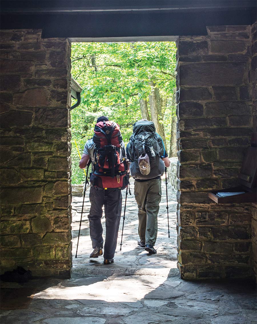
Mountain Crossings at Walasi Yi. By Mike McCoy
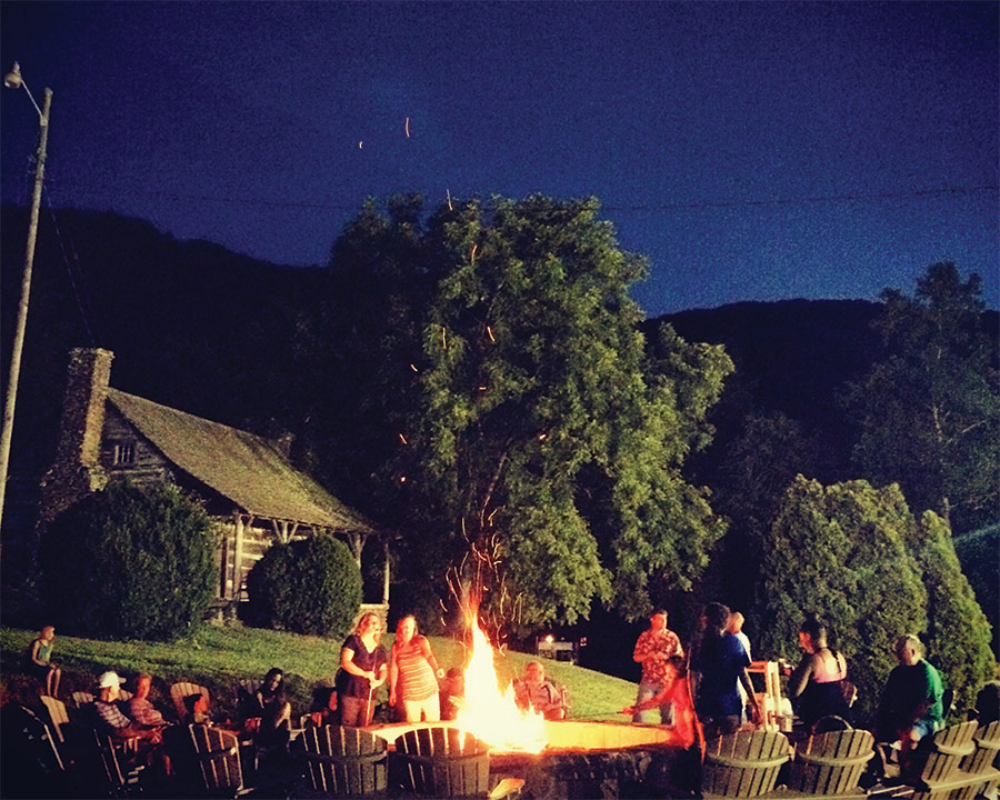
Cabin at Fontana Village Resort & Marina. Courtesy Fontana Village Resort
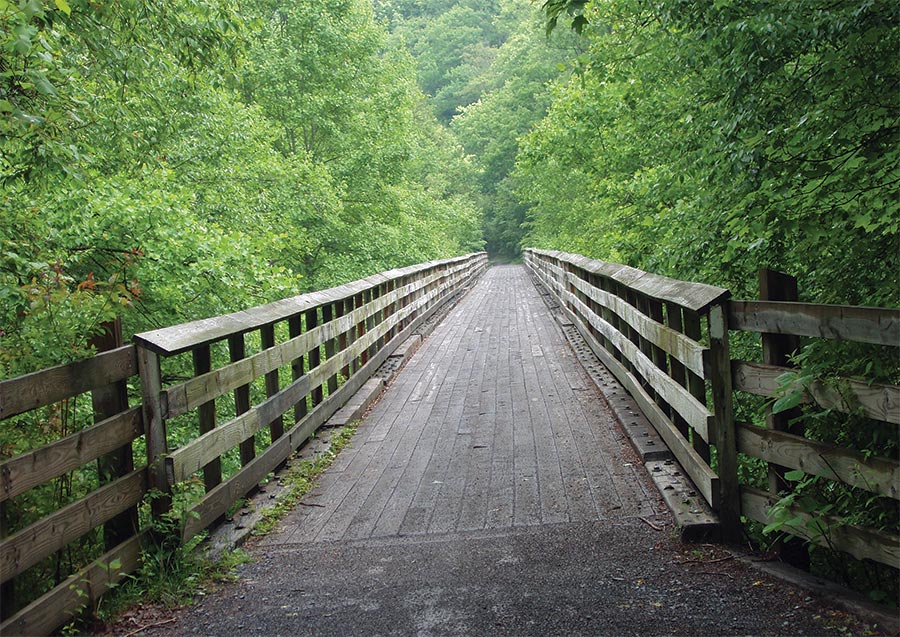
Just 12 miles from the Appalachian Trail, Abingdon is a hub of outdoor recreation. The town is an ideal place to hop on the 35-mile Virginia Creeper National Recreational Trail.
Surrounded by the high peaks of the southern Blue Ridge Mountains, Blairsville is also the home of the legendary Mountain Crossings at Walasi-Yi, the circa-1937 stone building constructed by the Civilian Conservation Corps that now houses one of the most beloved outfitters along the Trail. The A.T. even passes through a portion of the building, the only part of the entire path that’s covered. Not far from town is Vogel State Park, whose centerpiece is the stunning Lake Trahlyta. The lake is situated perfectly like a gemstone in a piece of jewelry, nestled among the surrounding mountains, and its smooth, calm surface makes it a popular destination for boating and fishing. The park offers many great trails on its own, as well as connectors to the A.T. where hikers can summit Blood Mountain, which, at 4,459 feet, is the A.T.’s highest-elevation ascent in Georgia.
Virginia Creeper National Recreational Trail
Across the border into North Carolina, I was intrigued to read about the A.T. Community of Fontana Dam. This town was expressly built in the 1940s to house the Tennessee Valley Authority workers who built the massive engineering marvel, still the tallest dam on the Eastern Seaboard at nearly 500 feet. The Trail follows the curving top of the dam, offering hikers terrific views of the Great Smoky Mountains just beyond. The dam-created Fontana Lake also offers some 240 miles of shoreline and ample recreational opportunities. The centerpiece of the town, however, is the famous Fontana Village Resort and Marina, which features a lodge, cabins, dining, golf, and other activities — making it a relaxing stop for both thru-hikers and section hikers. The resort hosts the annual Hiker Haze weekend in March — with food and other activities that kick off the spring hiking season.
Located just a half-hour away from Fontana Dam, about midway to Bryson City, is the Stecoah Valley Cultural Arts Center. I once drove miles out of my way to buy my musician husband a cookie-tin banjo from the Blue Ridge Music Center in southern Virginia, and so the Stecoah Center seemed right up our alley. Housed in a historic stone structure that dates to the 1930s, the center was once the site of a school but is now a community and cultural center that offers classes and programming in music, cooking, and crafts all year long. The center is famous for its “An Appalachian Evening” summer concert series, with bluegrass, folk, and old-time mountain music offered weekly. Looking at photos of past concerts, I could easily imagine my husband, after a day of hiking on the A.T. and a night of music at Stecoah, sitting around a campfire and plucking his own Appalachian banjo under the stars.

Living in Virginia, my family and I get out to Shenandoah National Park fairly regularly, and we’ve hiked on several portions of the A.T. as it spans the 100-mile length of the park. I never get tired of the stunning views from the ridgetops across the wide expanse of the Shenandoah Valley, quilted with farms and ribboned by the Shenandoah River. We often stop in the many homey towns near the park, such as Front Royal and Luray, for some pie or apple cider donuts to take home. One place I’ve never visited, however, is the A.T. Community of Abingdon, Virginia. One of currently 15 A.T. communities in the state, Abingdon is located near the southern tip of Virginia’s long Appalachian spine, and it offers terrific Trail access as well as many dining and lodging options.

Just 12 miles from the Appalachian Trail, Abingdon is a hub of outdoor recreation. The town is an ideal place to hop on the 35-mile Virginia Creeper National Recreational Trail, a multi-use recreational trail built on a former railbed that dates to the 1880s. Hikers and cyclists can stop on one of the Creeper Trail’s high wooden trestles or take in views of the surrounding forests, farms, and fields. I particularly like the idea of a post-Trail visit to the Creeper Trail Café, which boasts of having “world famous chocolate cake.” (It’s hard to prove this claim, but I’m willing to investigate.)

I also am fascinated by the fact that Abingdon offers access to Virginia’s little-known slot canyons. When I think of slot canyons, I usually picture the orange-hued sandstone canyons of the desert West. But Virginia’s slot canyons are tucked away in the Great Channels Natural Area Preserve. Here, ice-age freezing and melting have split cracks in the relatively soft Blue Ridge sandstone, allowing narrow, winding canyons to form. These canyons have only been open to the public for about a decade, the result of a land donation from the Nature Conservancy. Getting to and from the slot canyon requires a 6.6 mile-hike with some elevation change, but from certain overlooks, hikers have an almost 360-degree view of the surrounding Blue Ridge.

Parker Lake from the A.T. in Wawayanda State Park. By Raymond Salani III
As I daydreamed about places to visit along the Trail, my eyes drifted north on my A.T. map to a community that seemed very different from the Blue Ridge towns of the south and mid-Atlantic. Located right on the New York-New Jersey line, the town of Warwick, New York, is significant in Appalachian Trail history as the location where the first section of trail opened in 1931, six years before the rest of the Trail was officially inaugurated. Although Warwick still retains its slower pace and rural character, with historic brick buildings lining the streets, the town is only 55 miles from New York City and therefore relatively easy for urban hikers and families to get to. Lodging and dining options abound, along with a range of outdoor activities.

Warwick offers a special wildlife viewing experience for hikers, too. Connected via a spur to the A.T., the Mount Peter Hawk Watch Trailway leads to a scenic overlook for raptor viewing and birdwatching, and binoculars are a must. One of the oldest hawk watch locations in the country, the overlook offers both casual and seasoned birdwatchers glimpses of up to 16 species, including goshawks, kestrels, and golden and bald eagles, during their fall migrations. But even if you don’t spot any big birds, the mountain views from the overlook are worth the look on their own.

Wawayanda State Park in New Jersey is another popular destination not far from Warwick. The park contains some 60 miles of trails, including 20 miles of the A.T. Here hikers can walk on the A.T. before taking a spur trail that leads to the “Stairway to Heaven,” a series of rock steps up to the Pinwheel Vista, an outcropping with rewarding views. I’ve hiked a similar kind of rocky climb called Pole Steeple near the A.T. in central Pennsylvania, so this hike sounded like a fun challenge. Back on flat ground in Warwick, any itinerary would have to include the Pennings Farm Market, which offers not just farm-fresh and locally sourced produce, meats, and cheeses, but also a pub, garden center, and ice cream stand.

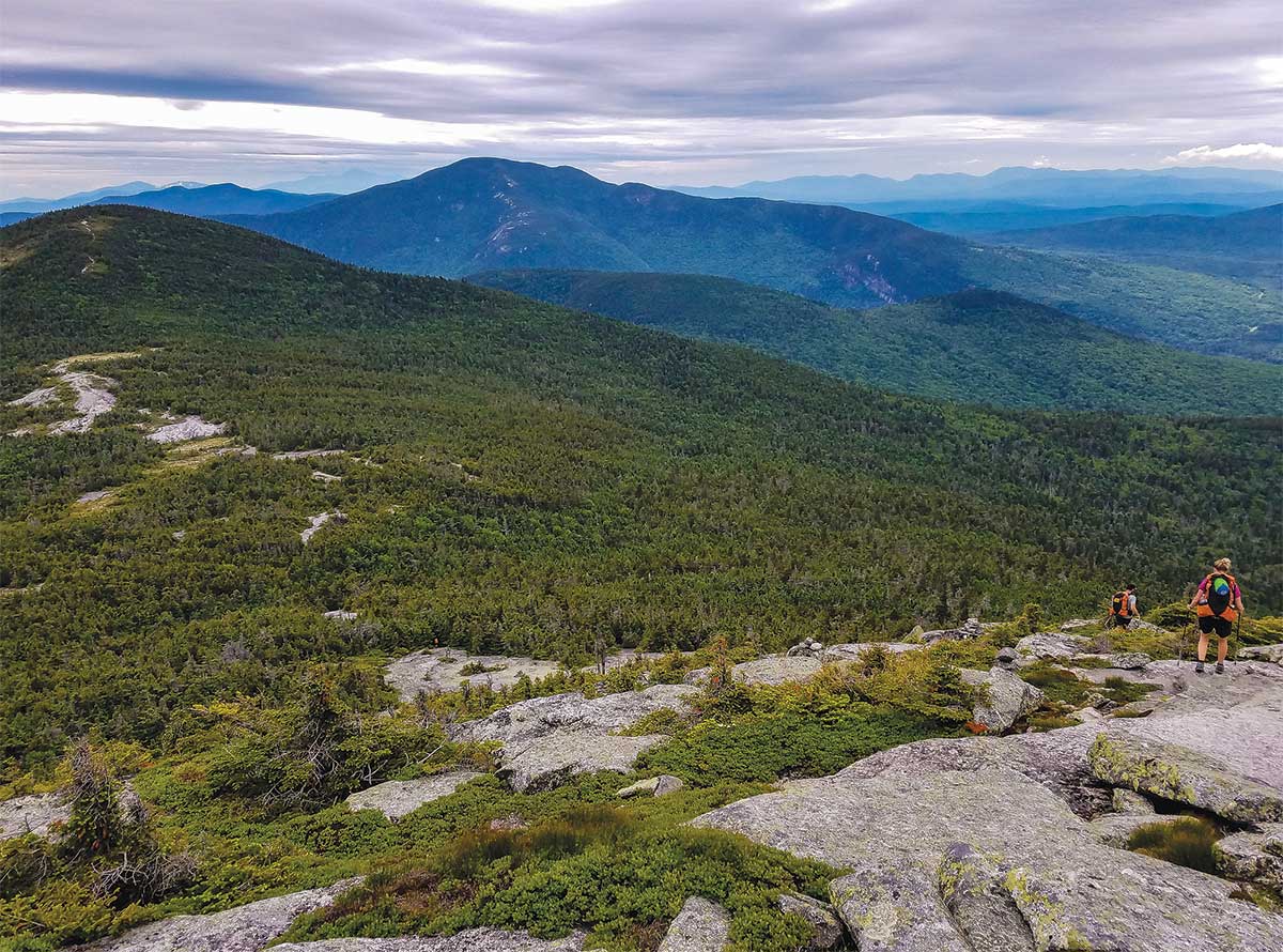
Kingfield, Maine is perfectly situated as a gateway to the scenic riches of the region and is a welcoming place for A.T. hikers.
A.T. from the Grafton Notch area of the High Peaks region in Maine. By Greg Morgan
Heading towards the northern terminus of the Appalachian Trail lies the A.T. Community of Kingfield, Maine, located about two hours north of Portland by car. Although I’ve visited the central coast of Maine several times, I haven’t spent much time in Maine’s interior, especially its High Peaks region, which contains many of the state’s 4,000-foot mountains. Although it’s a modest town of less than 1,000 people, Kingfield is perfectly situated as a gateway to the scenic riches of the region and is a welcoming place for A.T. hikers. Located less than a mile from the Appalachian Trail, for instance, is the Sugarloaf Ski Resort, the second-largest skiable area on the Eastern Seaboard next to Killington, Vermont, and the second-highest peak in Maine next to Katahdin, the A.T.’s northern endpoint. Kingfield is also the headquarters for Maine Hut and Trails, which provides bunkhouses and lodges where A.T. hikers may exchange work for room and board (or pay a nightly rate that either includes meals or a rate without meals).

At last, I folded up my map, my mind full of possibilities, and thinking of all the other communities along the Trail with historic character, natural features, and fun activities for people who want to take just a few steps off the path. It was time to start packing and get out there.

Share: