Broadening the Vision of the A.T.
Summiting a mountain is a culmination. You’ve hiked and climbed, up and up, until there is nowhere else to go but down. It is a satisfying conclusion — a coming to fruition. But summiting a mountain can also feel like a beginning: With a panoramic view of everything around you, you’ve expanded the boundaries of what you thought was possible. You’ve created the promise of a new goal, perhaps a chance to climb even higher next time. You’ve offered yourself a new perspective. So it was with Benton MacKaye.
In July 1900, MacKaye had hiked the top of Stratton Mountain in Vermont, which afforded him a sweeping 360-degree view of the surrounding Green Mountains. From that vantage point (on a tree limb), he could see into four states at once, but in fact, his mind carried him much farther. It was here that he envisioned a long-distance trail on the spine of the Appalachians, a green ribbon from Maine to Georgia. But for MacKaye, his vision was even broader than that. His idea was not just for a narrow path but a long, wide swath of wilderness that encompassed cultural resources from communities that would become beneficiaries of the Trail — and eventually — beyond that vision – stewards.
By Kim O’Connell

The A.T. centerline along the eastern U.S.
Image courtesy Visible Earth/NASA

Just like a mountain summit, the Trail would not be the culmination of his vision, but the beginning: “The trail itself is merely a means of access,” MacKaye once said. “When this is done the real job can commence: indeed it need not wait on this — it can begin with the building of the trail. The real job is to develop a particular environment in each particular Wilderness Area penetrated by the Trail.” The “particular environment,” according to MacKaye, was one where people held a view of nature that was broad and deep, that understood its importance to the health of our communities, our ways of life, and our bodies and minds. And that it had this greater purpose, too, for all the wildlife that depended on it.
The “particular environment,” according to MacKaye, was one where people held a view of nature that was broad and deep, that understood its importance to the health of our communities, our ways of life, and our bodies and minds. And that it had this greater purpose, too, for all the wildlife that depended on it.
Understandably, especially for those who fought for its creation, advocates have often focused on the A.T. simply as a footpath, and it certainly is that — more than 2,100 miles of exhilarating recreational opportunities and access to some of the Eastern Seaboard’s most beautiful vistas. But nearly 100 years after the Trail was envisioned, we have come to have a greater appreciation for the Trail as the centerpiece of a mosaic of landscapes, communities, and people. It is a repository of sorts, too — an embodiment of the thousands of untold hours people have spent clearing and protecting this path, telling its stories, and keeping its many traditions. Working from this new perspective has brought the Appalachian Trail Conservancy (ATC) and its allies much closer to realizing MacKaye’s sweeping vision, and even going far beyond the scope of what he foresaw from the summit of Stratton Mountain.
As we pivot deeper into the 21st century, the A.T.’s role as the heart of the Wild East landscape has become even more essential. As a long-distance natural corridor, it provides crucial, contiguous habitat for animals, including migratory birds; it allows for the preservation of natural darkness, which contributes to the health of many animals (including humans); and it is the connective tissue for a diverse set of communities that both benefit from it and contribute to its care. The ATC’s wide-ranging landscape conservation program, for example, works closely with more than 100 nonprofit partners and state and federal agencies, through outright land purchases or conservation easements, to protect areas outside the Trail corridor from damaging or detracting development. This, too, builds on MacKaye’s vision of the Trail as a counterpoint to urban sprawl. “We do not propose to tear down the metropolitan environment,” he said, “…the proposal is to build up the indigenous environment.” To make the mountains match the metropolises — at least in terms of their relative importance in our lives.
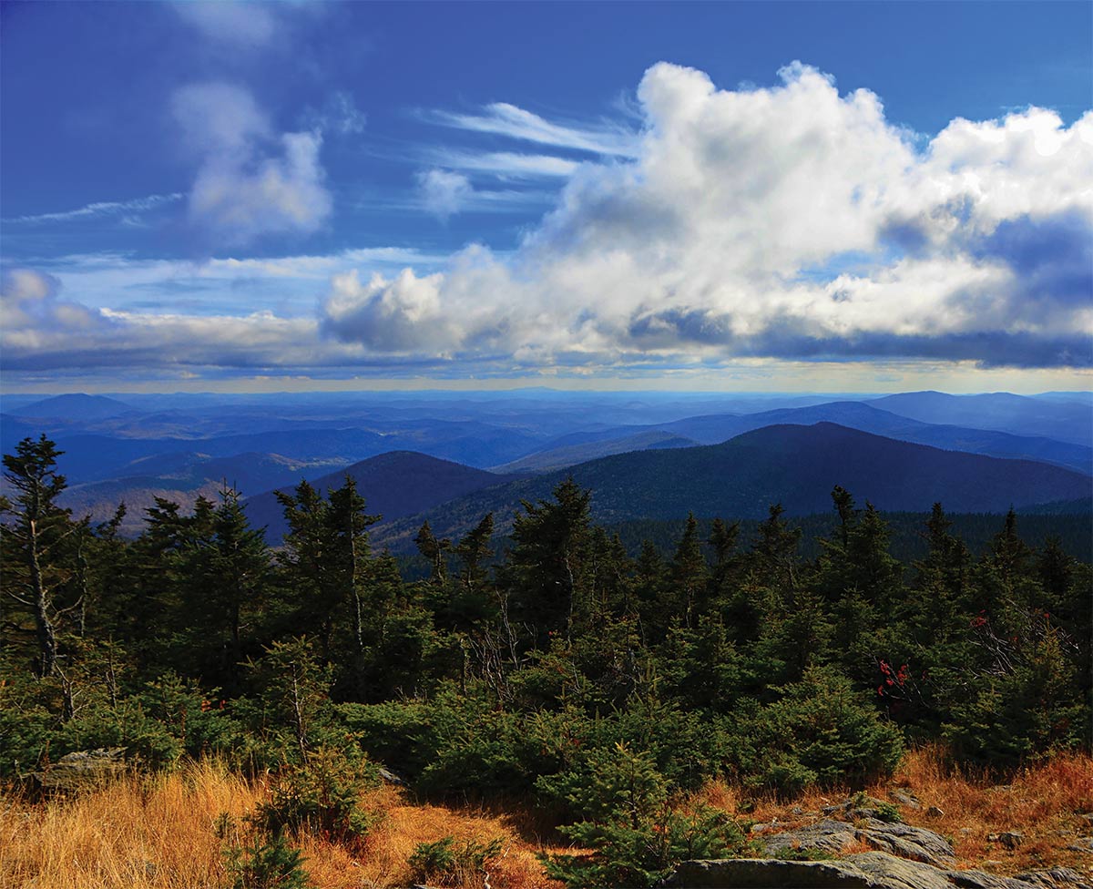
the ridgelines of Bromley, Stratton, and Glastenbury Mountain

View of The A.T. from the summit of Killington Peak in Vermont (Including the ridgelines of Bromley, Stratton, and Glastenbury Mountain) – By Raymond Salani III

Today, these mountain areas are more important than ever. We hear a lot about the concept of resilience these days with respect to climate change. Resilience, in this capacity, is the ability of a place to absorb external stresses and remain functional in the face of the potentially devastating effects of climate change, including flooding, rising temperatures, and more damaging storms. Much effort has been rightly directed towards renovating urban buildings and infrastructure to withstand those kinds of threats. But the A.T. corridor is like a backbone: It provides strength. It helps the Eastern Seaboard to be resilient. Through its diverse landscape — which includes rolling hills, grasslands, mountains, valleys, and particularly forests — the A.T. sequesters carbon dioxide, helps to keep ecosystems in balance, and protects against erosion and stormwater runoff. More than a recreational resource, the Trail and its myriad natural values are especially relevant due to its proximity to so many populated urban environments along the eastern U.S.

It’s not enough, however, for our cities and our natural areas to be resilient. We must be resilient too. We must be able to meet the challenges of our lives, to breathe deep and restore ourselves, and to put one foot in front of the other until we gain a new perspective. That’s what climbing Stratton Mountain did for Benton MacKaye. That’s what visting the A.T. — and protecting its surrounding landscapes and communities — does for all of us.

Share: