Every footfall on the Appalachian National Scenic Trail connects to the flow of human history that is anchored in geology and influenced by the north-south mountains and gaps. It is here in the Wild East when outdoors, and within the largest natural corridor east of the Mississippi River, that time travel feels possible.
As I prepare for a backpack trek across several magnificent balds this summer, I’m studying up on more than the thrushes, warblers, and vireos I hope to hear and see. I’m willing to add the extra weight of relevant history pages from the A.T. Guide to Tennessee-North Carolina, along with the A.T. Thru-Hikers’ Companion. The trick is to grasp the big picture beforehand and then study the clues and stories for each day. At the Clyde Smith Shelter, I’ll look for two rows of maple trees that signal an old driveway to a vanished homestead. Near the junction with Highway 19E, I’ll scan for black magnetic iron, leftovers from the long-closed Wilder Mine, where ten railroad cars hauled the last ore away in 1918.
When I hike over Jane Bald Summit, I’ll think of the two North Carolina sisters, Jane and Harriet Cook, and their ill-fated 1870 trek home from visiting relatives in Tennessee. Harriet fell ill with milk sickness (from cows eating a kind of snakeroot and poisoning the milk) and was too weak to walk. They spent a freezing November night on this ridge. Jane hurried for help in the morning. Rescuers brought Harriet out by wagon, but she died the next day. She was 24. Stories are sprinkled throughout the Trail. They link hikers to poignant dramas and significant historical events.
Some 480 million years ago, the buckling, folding, and faulting of colliding continental plates defined violent beginnings, perhaps a prelude to what would come much later in human conflicts. Once, the Appalachians jutted skyward as high as the Himalayas. Over the millennia, a series of mountain building events shaped the ranges of today. Erosion gentled and lowered the summits, yet there are no shortage of steep ascents, rocks, and roots interspersed with the bliss of ice-cold springs, waterfalls, sheltering forests, wildflower meadows, and the gaps between high points that played a vital role in human history.

For white settlers from the sixteenth to seventeenth centuries, the daunting march of Appalachian Mountains formed a physical obstacle, and then a mystical frontier between the Atlantic and the wonders of the West. The arrival of some 200,000 Scotch-Irish from 1710 to 1775 marked a push into the spine of the Appalachians. Initially, they sought cheap land and a new life in New Hampshire and Maine. Many moved on to Pennsylvania and others to the southern mountains, giving rise to the music and culture of Appalachia. Another barrier appeared in the clash of cultures as the Scotch-Irish intruded upon the tribal homelands, contributing to tragic episodes in mountain history. None are more infamous than the Cherokee Trail of Tears that followed the 1830s Indian Removal Act.
In times of war, the gaps proved strategic places to defend. During the Civil War, Confederates and Union forces sought to control access to the Shenandoah Valley — both for its resources and as a thoroughfare for supplies and regiments. Three gaps on the A.T. in the Shenandoah National Park section proved pivotal for the Confederates in 1862 — Browns, Rockfish, and Swift Run Gaps.
In that same era, beginning in 1851, slaves seeking freedom navigated a mountainous route near or on today’s A.T. to cross the Mason-Dixon line into Pennsylvania. Most of the Underground Railroad routes likely followed the more forgiving mountain flanks.


Observation Tower
John Brown’s Raiders
Underground Railroad
— Forging Iron from an Ancient Mountain
Largest Oak on the A.T.
9,000-Year-Old Quarry
1826 Landslide
Heavy Portage of 1775
The high elevations in turn offered a corridor for northern forests to expand far southward, and for the great migrations of birds catching updrafts and finding shelter. Those natural qualities persist in the Wild East, along with the relics of logging, clearing the woods for farms, fuel, and war. Awe-inspiring primeval forests remain in pockets and within the Great Smoky Mountains National Park, saved from the saw by the rugged terrain and the foresight of early conservationists. There’s a renewal story, too, in the returning forests and in our evolving relationship with trees, valuing them for storing carbon, anchoring watersheds, hosting wildlife, and nurturing the human spirit.

In October of 2018, members of the Eastern Band of Cherokees gathered with partners from the Trail of Tears Association, and NPS staff from that national historic trail, and the ATC to dedicate North Carolina’s first Trail of Tears historic marker at the Nantahala Outdoor Center’s junction with the A.T. One arrow points five miles to Fort Lindsay, where soldiers rounded up the mountain Cherokees, and the other arrow points 895 miles to Woodhole’s Depot in Oklahoma. The Museum of the Cherokee Indian, in nearby Cherokee, North Carolina, is dedicated to “preserve and perpetuate the history, culture, and stories of the Cherokee people.”

For my own small journey on the A.T. this summer, I’m feeling inspired to hike with greater attentiveness to layers of history and the stories floating on the breeze, conveyed in the bird songs, shining down from brilliant stars, and stirring among untended apple orchards merging with wild forests. I believe if you want to time travel, you need to remove yourself from the hustle, noise, and technology of our modern society. There’s no better place than within the Wild East and the lifeline of the Appalachian Trail.

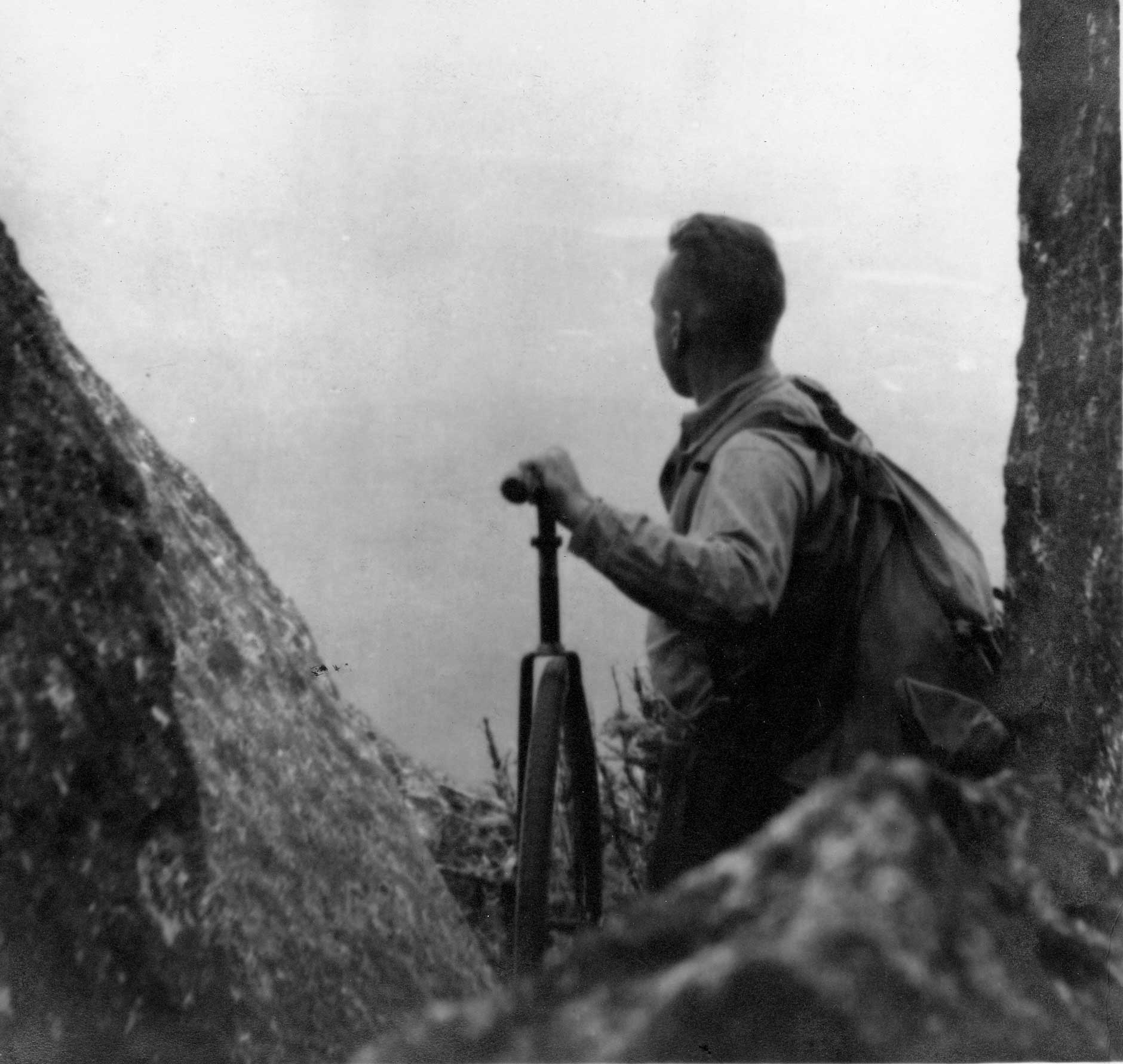
Myron Avery with measuring wheel on the Knife Edge in 1933 — on his way to set his first summit sign – Courtesy Maine State Library

The most unique facet of the Trail, alongside scenic beauty, is the roughly 6,000 volunteers organized through 31 A.T. partner clubs that keep the Trail alive, over its 2,191 miles from Maine to Georgia.